

NERP TE Project 2.1 - Marine turtles and dugongs of the Torres Strait (JCU)
Project summary
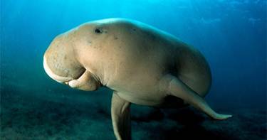
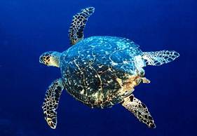
The project is studying the status of threatened marine (green, hawksbill and flatback) turtles and dugongs in the Torres Strait and threats to these populations. The researchers will investigate links between different populations of dugongs and turtles in terms of movement and habitat use. They will also assess the abundance of dugongs in the Torres Strait using aerial surveys.
Why this research is needed
The project will improve stakeholder understanding, capacity and skills to better manage these priority species and provide valuable data that is useable and understandable to those making decisions about turtles and dugongs.
Research-user focus
The project aims to enhance the ability of government and community to manage these threatened species and also add value to the evolving dugong and turtle management plans and the Torres Strait Land and Sea Ranger Program. Identified research users include the Torres Strait Regional Authority, the Department of Sustainability, Environment, Water, Population and Communities, the Great Barrier Reef Marine Park Authority, the Australian Fisheries Management Authority and the Queensland Government.
Outcomes
- The project should lead to the following outcomes:
- Improved population viability and stability of marine turtles and dugongs.
- Improved stakeholder understanding, capacity and skills to better monitor and manage priority species.
- Improved non-indigenous participants' knowledge of traditional ecological knowledge and cultural aspects of dugong and turtle management.
Reports, Publications and News
For more information see Project 2.1 'Marine turtles and dugongs of the Torres Strait' on the NERP Tropical Ecosystems Hub site.
Images
Datasets
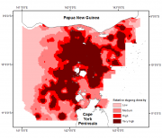
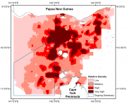
This dataset shows (1) a raster spatial model of the distribution and relative density of dugongs (Dugong dugong) in the Torres Strait region based on an aggregate of 27 years (1987 - 2013) of systematic aerial surveys; and (2) a raster spatial model of the distribution and relative density of marine turtles (green turtles, Chelonia mydas) in the Torres Strait based on an aerial survey conducted in 2013.
This dataset shows a raster spatial model of the distribution and relative density of dugongs (Dugong dugong) in the Torres Strait region based on an aggregate of 24 years (1987 - 2011) of systematic aerial surveys.
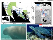
This dataset consists of the home ranges and satellite tracks taken from eleven dugongs and ten green turtles.
Methods:
Fast-acquisition satellite telemetry was used to track eleven dugongs and ten green turtles at two geographically distinct foraging locations in Queensland, Australia to evaluate the inter- and intra-species spatial relationships and assess the efficacy of existing protection zones. Home-range analysis and bathymetric modeling were used to determine spatial use and compared with existing protection areas using GIS.

The project will determine the status of threatened marine (green, hawksbill and flatback) turtles and dugongs in the Torres Strait and threats to these populations. It also will investigate links between different populations of dugongs and turtles in terms of movement and habitat use. They will also assess the abundance of dugongs in the Torres Strait using aerial surveys.
Working in conjunction with the Torres Strait Regional Authorities (TSRA) Land and Sea Unit and the TSRA Community Ranger program this project will: