
Articles
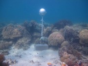
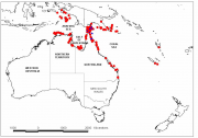
As part of the NERP TE project 2.3 temperature loggers were deployed at 15 sites across the Torres Strait to measure ocean temperature.
No-take marine reserves (NTMRs) are widely advocated for conserving exploited fish stocks and biodiversity.
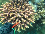
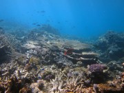
The crown-of-thorns seastar, Acanthaster planci, is a predator of corals and along with cyclones is the major cause of coral mortality on the Great Barrier Reef (GBR) 1 .
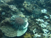
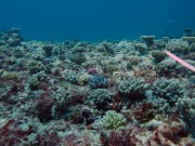
Corals are the back bones of coral reef ecosystems. They produce calcium carbonate skeletons that build coral reef framework.

The Winds of Zenadth Cultural Festival takes place every two years on Thursday Island.
Within a funding structure such as NERP TE, 'governance' is often described within the narrow framework of program roles and respon
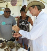
During trips to Torres Strait in collaboration with TSRA in 2013 and 2014 coral skeletons were collected under a permit issued by the Commonwealth of Australia under the Torres Strait Fisheries A
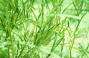
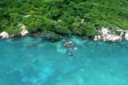
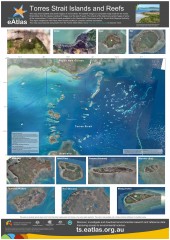
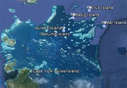
The Torres Strait marine environment contains a relatively shallow (<20m) and highly productive stretch of seawater between the tip of Queensland and Papua New Guinea. It straddles the juncture of the Indian Ocean (Arafura sea) with the Pacific Ocean (Coral Sea), resulting in complex patterns of influence from the two ocean systems, including complicated tides and currents, and high biodiversity. Torres Strait contains over 100 islands, and a diversity of marine habitats including coral reefs, seagrass meadows, and rich benthic garden communities.
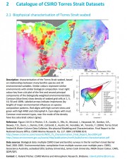
This milestone report presents a catalogue of information for the most significant and updated data sets, metadata and map compositions for the Torres Strait region, which may be suitable for inc
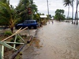
This report provides a synthesis of research on climate change and coastal science in the Torres Strait, and has been produced for the Australian Government’s Marine and Tropical Sciences Research Facility (MTSRF). It identifies and summarises work to date on reef evolution, hydrodynamics and sedimentary environments throughout the Torres Strait. It describes the island dynamics at Boigu, Saibai, Masig, Poruma, Warraber and Iama Islands. Numerous studies relating to climatic change are reviewed and the most relevant regional predictions for climate change in the Torres Strait are presented. The potential physical and ecological impacts of these changes in the Torres Strait are also identified. Adaptation and mitigation measures are suggested and their outcomes and consequences are evaluated. The key principles from sustainable land use plans on the islands are summarised and knowledge gaps in the fields of both coastal and climatic science are identified to guide future research.
As part of its commitment under Theme 5 of the MTSRF, the Reef and Rainforest Research Centre publishes, or makes available, outputs (e.g. final technical or scientific reports, synthesis reports) from MTSRF-funded research projects nested within Research Themes 1-4.
Researchers funded through the Australian Government’s Marine and Tropical Sciences Research Facility (MTSRF) have worked closely with Torres Strait communities to improve our understanding of both the vulnerability of Torres Strait islands to climate change, and their adaptation capacity.