

Winds of Zenadth 2014 - Torres Strait eAtlas stall
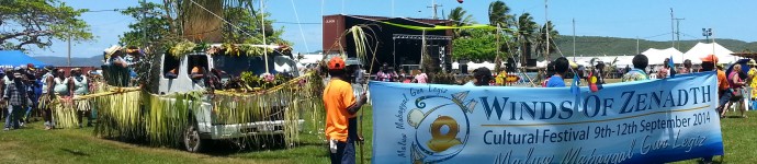

The Winds of Zenadth Cultural Festival takes place every two years on Thursday Island. The festival is a community event that brings people together and showcases the strength and diversity of the Torres Strait people’s culture and customs.
The eAtlas information stall at the festival in September 2014, provided an opportunity for the community to try out the mapping and visualisation tools and to get familiar with the look and feel of the site. The most important message for the community was that the Torres Strait eAtlas is an internet site that is free for everyone to use.
"The Torres Strait eAtlas is a valuable tool that will enhance community access to information about their environment", said AIMS researcher Eric Lawrey. "For us running the eAtlas stall at the cultural festival allowed us to directly interact with the community, see how they use the system and what they find most useful."
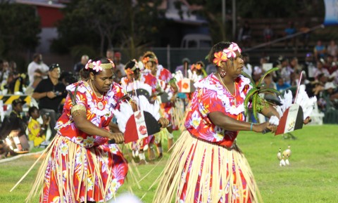
The Neguams Dance Troupe performing at the Winds of Zenadth festival on Thursday Island, 2014.
The four days of the festival was jam-packed with dancing in the evenings but the early afternoon was a chance for people to browse the culture and information stalls. The website (ts.eatlas.org.au) was running on a large touch screen and attracted people of all ages. The high resolution imagery of the islands was especially popular. Both children and adults enjoyed exploring, talking about places on the maps and showing the maps their home island to friends. The level of spatial literacy was very high and even the smallest of children were able to find places of interest and navigate around the islands.
To encourage people at the festival to try the mapping system, there was a short activity to complete and be rewarded with a free eAtlas hat. Newcomers were shown how to add layers and then followed some simple instructions to add dugong densities and shipping traffic layers to the map. The idea of searching for data and adding map layers was learnt quickly, especially by the children. The simple visualisations were effective and made it easy for users to understand relationships between the biological and environmental data.
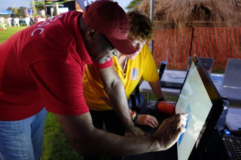
The touch screen at the eAtlas information stall provided an opportunity for people to try out the internet site ts.eatlas.org.au

Overall the level of interest among adults was lower than among young people.
"We were particularly popular with the children at the festival, some of them coming back every day and playing with the maps for over 20 minutes each time. The children were all very computer literate and had a surprising talent for geography, having no problems translating their knowledge of places to a flat top down map," said Eric Lawrey.
"We had 46 children and 28 adults try out the eAtlas at the stall, with the most popular aspect being to use the high resolution imagery to find their homes and show others where they are from. People were also keen to find information on dugongs, turtles and the geology of Torres Strait. Overall we received lots of very positive feedback."
Thanks to Tim Hillier from Tagai College, the eAtlas team were also able to show the eAtlas to a range of year 11 and 12 classes at the secondary school. The students were taken through a range of activities including: how to find and investigate information on the site, the distribution of turtles and dugongs, the density of ship traffic and how to make a map to put it in an assignment. One class used the eAtlas to create a map for their current oceanography assignment.

Year 11 Conservation and Land Management students using the Torres Strait eAtlas to gain a better understanding of their region and how to use it to make basic maps.
Attendance at the festival was high and the visibility of the eAtlas information stall was excellent. Overall during the week the Torres Strait eAtlas was demonstrated to over 110 local people. The response so far suggests that further effort in adding data visualisations that allow exploration of the island maps and in promoting the eAtlas for use by the general community will encourage acceptance and use on the eAtlas in Torres Strait.