
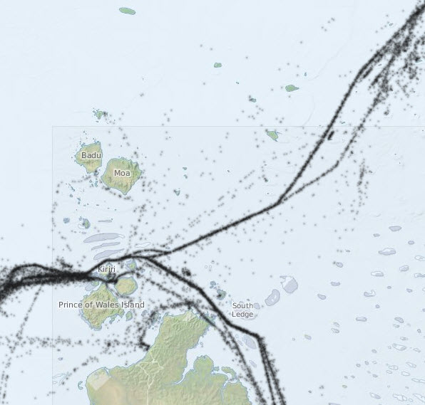
Shipping traffic in Torres Strait - Preview map

Photographers: Eric Lawrey
Description
This is a preview of an interactive map showing the location of large ships travelling through Torres Strait. It shows the position of ships captured at 1 hour intervals from the Automatic Identification System (AIS) from 5th April - 22nd Aug 2013. Find out where ships really go.
Image produced for the project